Desk review
As a first step in the data collection process, the team should obtain and review policies, standards, regulations, and plans that are relevant to walking and cycling. Typical documents to be covered in the review include the following:
- Transport master plans
- Urban development/land use plans
- Reports and designs for ongoing transport projects, including street improvement projects, highway projects, mass rapid transit projects.
- Transport legislation, regulations, strategies, and policies
- Road safety data: Crash records, consolidated crash statistics
Through these documents the team should aim to obtain the following types of information:
- Demographics: City population and growth trends
- Travel behaviour: Mode split, trip lengths, vehicle ownership
- Public transport system: Route network, stop locations, mass rapid transit lines (if applicable)
- Road safety data: Map of black spot locations, annual fatalities by mode.
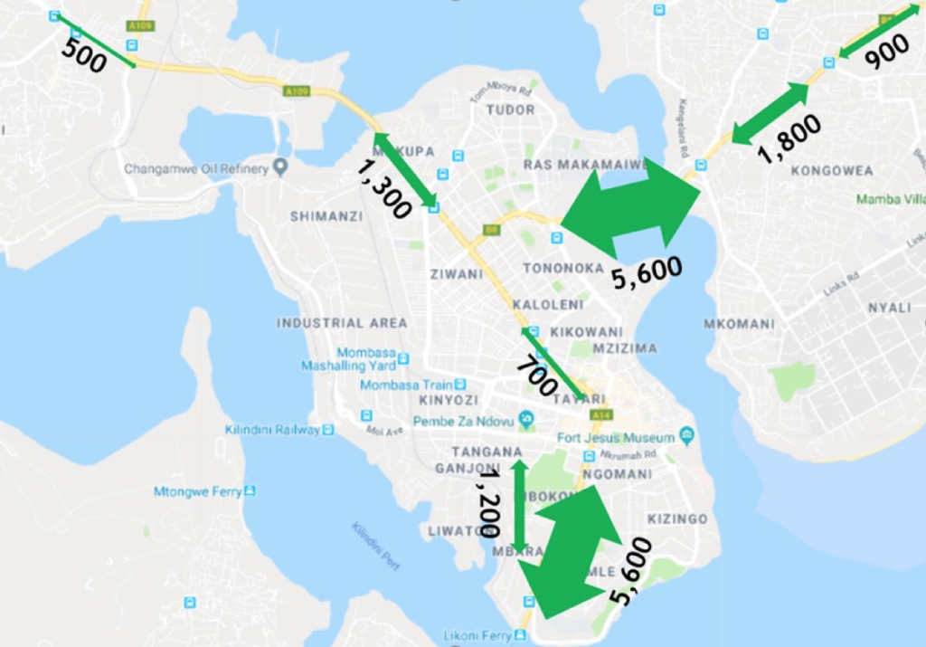
- Traffic counts: NMT user volumes on specific corridors
Field surveys
The following field surveys can help assess the quality of the existing NMT environment and NMT travel patterns.
- Existing NMT condition survey. The NMT environment surveys assess the level of provision of critical NMT facilities, such footpaths, cycle tracks, pedestrian crossings, traffic calming measures, street lighting, shade, storm water drainage, street vending, and parking. This information is collected at the scale of the city block. Several study areas across the city should be selected to gain a representative sample of different urban typologies. The survey typically includes the following steps:
- Prior to the field survey, the team should identify study areas that represent a range of land uses (e.g., residential, commercial, institutional, open space, industrial) and socioeconomic characteristics (e.g., low to high income). All major streets in each study area should be mapped and each block assigned a unique number for identification.
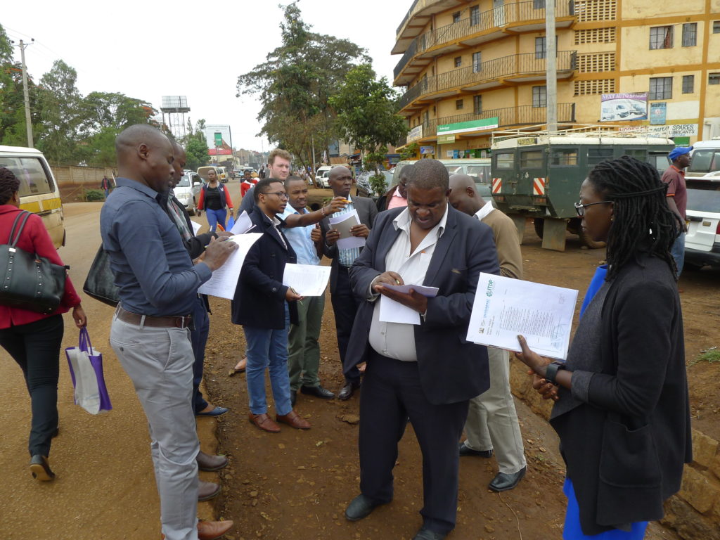
- Street conditions are captured using the smartphone application (e.g., Device Magic, GIS Cloud). The app allows a surveyor to record street characteristics and remotely upload the information to an online spreadsheet. Surveyors should walk along each street, recording the presence of NMT facilities on each block.
- The data from the surveys are then cleaned, mapped, and analysed using a GIS platform (e.g., QGIS or ArcGIS).
- Survey of NMT user movements. Information on NMT volumes can help the team prioritise specific street interventions as part of the NMT strategy. NMT snap counts can be conducted as part of the NMT condition survey (see above) or as a separate survey. The data should be captured using a smartphone application (e.g., Device Magic, GIS Cloud) for the ease of data management.